AVIS Project Update: Second pilot on the Danube complted! Discover results here!

Lower Danube pilot: Results
Validating AVIS in a new river environment
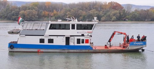
Following the successful first pilot on the Guadalquivir River, the AVIS project entered a new phase of operational validation with a second pilot campaign on the Lower Danube. This campaign provided an opportunity to test the AVIS prototype in a different inland waterway environment, with its own navigation conditions, constraints and operational challenges.
While the first pilot demonstrated that the AVIS system could be successfully deployed and used in real navigation conditions, the Lower Danube campaign focused on understanding how the system performs in a more complex river environment. The pilot allowed the team to further assess the contribution of European space data services, including satellite navigation, integrity information, authentication services and Copernicus-based monitoring, during live navigation.
This second campaign therefore played an important role in expanding AVIS validation beyond a first operational demonstration. It confirmed several promising results, while also providing valuable insights into the conditions that can affect system performance in practice.
Putting AVIS to the test on the Lower Danube
During the pilot, the AVIS prototype was operated in real navigation conditions, combining GNSS-based positioning, integrity monitoring, OSNMA authentication and Copernicus-based river monitoring services.
The objective was not only to confirm that the system could operate during navigation, but also to observe how it behaved when exposed to the specific characteristics of the Lower Danube environment. These included bridge crossings, narrower river sections, channelled areas and locations with more limited connectivity.
By testing AVIS in this context, the campaign helped identify where European space data can provide strong operational value, and where additional refinements may be needed to further improve its use in inland waterway navigation.
Performance in real navigation conditions
The positioning results obtained during the Lower Danube pilot were encouraging. The system delivered promising accuracy levels, supporting the potential use of satellite navigation services for inland waterway operations.
During general navigation, satellite navigation services remained highly available, and authentication services also showed strong continuity. Integrity information was available for most of the route, allowing the system to monitor the reliability of positioning information during navigation.
The pilot also made it possible to observe how the system reacted in more challenging situations. Bridge crossings, for example, were found to temporarily affect performance, mainly because they can reduce satellite visibility. However, the system generally recovered quickly once the vessel had passed these areas, which is an important result from an operational perspective.
No spoofing was detected during the campaign, even when the vessel navigated towards areas where such events are known to occur. At the same time, the pilot provided useful indications of possible signal disturbances, showing the importance of testing AVIS in real environments where conditions may differ from what is expected in nominal scenarios.
Copernicus services in a different river context
The Lower Danube pilot also provided valuable insights into the use of Copernicus-based services for inland waterway navigation and planning.
Compared with the Guadalquivir pilot, fewer Copernicus alerts were observed. This result was consistent with the characteristics of the pilot area. In some sections, the river is enclosed by walls, meaning that the river width cannot physically change in a significant way. In these areas, few or no river width change alerts were expected, which was confirmed during navigation.
The campaign also showed that Copernicus-based alerts can provide useful support for planning activities. Where alerts are generated, they can help vessels and authorities identify areas where river conditions may require attention. This confirms the potential of Copernicus data as an additional source of situational awareness for inland waterway operations.
At the same time, the pilot highlighted some limitations. In narrower river sections, riverbank interference can affect the accuracy of river edge detection. In addition, limited 4G and 5G connectivity in certain areas affected the availability of Copernicus data overlays on the onboard system. These observations are important, as they help identify the types of environments where further improvements may be needed.
A step forward in operational validation
The successful completion of the Lower Danube pilot marks another important step for the AVIS project. It confirmed that the system can continue to deliver promising results in real navigation conditions, while also showing how performance may vary depending on the river environment.
The campaign demonstrated the value of testing AVIS across different operational contexts. While the Guadalquivir pilot showed the ability of the system to operate successfully in a first real-life environment, the Lower Danube pilot brought additional lessons on more challenging conditions, including bridges, narrow river sections, possible signal disturbances and connectivity constraints.
These findings will support the further consolidation of AVIS results and help guide future refinements of the system. As the project continues, additional analysis will build on the experience gained during the Lower Danube campaign and contribute to the broader validation of AVIS capabilities for safer, smarter and more resilient inland waterway navigation.